Main Landforms on Earth and How They Are Formed
Understanding the Earth’s Physical Features and the Forces Behind Them
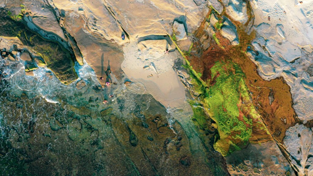
From towering mountains to vast plains and deep ocean trenches, the Earth’s surface is a diverse landscape shaped by powerful natural forces over millions of years. These physical features—called landforms—play a vital role in ecosystems, human settlement, weather patterns, and even the development of civilizations.
In this guide, we’ll explore the main types of landforms on Earth, how they are formed, and provide real-world examples to bring these geological wonders to life.
What Are Landforms?
Landforms are natural features of the Earth’s surface. They are formed by a variety of geological processes such as plate tectonics, erosion, weathering, volcanic activity, and sedimentation.
Landforms are typically classified by their size, shape, and origin, and can range from massive mountain ranges to tiny sand dunes.
1. Mountains
Definition:
Elevated areas that rise prominently above their surroundings, typically with steep sides and a peak or summit.
Formation Process:
Mountains form primarily through tectonic plate collisions. When two plates converge, the crust can buckle and be pushed upward, forming mountain ranges. Some mountains are also formed through volcanic activity.
Types of Mountains:
- Fold Mountains: Formed by the folding of Earth’s crust (e.g., Himalayas).
- Fault-block Mountains: Formed by blocks of crust tilting or lifting along faults (e.g., Sierra Nevada).
- Volcanic Mountains: Formed by volcanic eruptions (e.g., Mount Fuji).
Example:
- The Andes (South America) – formed by the subduction of the oceanic Nazca Plate beneath the South American Plate.
2. Plateaus
Definition:
Flat-topped highland areas that are elevated significantly above the surrounding terrain.
Formation Process:
Plateaus can form from uplift due to tectonic forces or lava flows that harden over time. Erosion of surrounding land can also leave behind a flat high area.
Example:
- Colorado Plateau (USA) – uplifted due to tectonic activity and shaped by erosion.
3. Hills
Definition:
Rounded elevations that are smaller than mountains.
Formation Process:
Formed by erosion, faulting, or volcanic activity, hills are often the result of worn-down mountains or sediment accumulation.
Example:
- Chiltern Hills (UK) – formed through tectonic uplift and subsequent erosion.
4. Valleys
Definition:
Low areas between hills or mountains, often where rivers flow.
Formation Process:
Most valleys are carved by rivers over time, through erosion. Glacial valleys are formed by the movement of glaciers.
Types of Valleys:
- V-shaped valleys – formed by rivers (e.g., Grand Canyon).
- U-shaped valleys – formed by glaciers (e.g., Yosemite Valley).
5. Plains
Definition:
Large, flat, or gently rolling areas of land with little elevation change.
Formation Process:
Formed by sediment deposition from rivers, lakes, or the ocean, or by erosion of surrounding highlands.
Example:
- Great Plains (USA and Canada) – created by ancient seas and river sediment.
6. Volcanoes
Definition:
Openings in the Earth’s crust through which magma, ash, and gases escape.
Formation Process:
Volcanoes form at divergent and convergent tectonic boundaries, and over hotspots. When magma rises to the surface and cools, it builds up the structure of the volcano.
Example:
- Mount Etna (Italy) – located at a convergent plate boundary.
7. Islands
Definition:
Land masses completely surrounded by water.
Formation Process:
Can form from volcanic eruptions, coral reef buildup, or the rising of land due to tectonic activity.
Types:
- Volcanic Islands – formed from erupting volcanoes under the sea (e.g., Hawaii).
- Continental Islands – once connected to a continent (e.g., Madagascar).
8. Deserts
Definition:
Arid regions with very low precipitation and sparse vegetation.
Formation Process:
Caused by climatic conditions (dry air masses), rain shadow effects, or cold ocean currents that limit evaporation.
Example:
- Sahara Desert (Africa) – shaped by climate and wind erosion.
9. Deltas
Definition:
Landforms created at the mouth of a river where it deposits sediments into a standing body of water.
Formation Process:
Formed when a river loses speed as it meets a sea or lake, causing it to drop the sediments it’s carrying.
Example:
- Nile Delta (Egypt) – a fan-shaped delta formed by sediment from the Nile River.
10. Oceans and Ocean Trenches
Definition:
- Oceans: Vast bodies of saltwater.
- Trenches: Deep depressions in the ocean floor.
Formation Process:
Trenches form at subduction zones where one tectonic plate is forced under another.
Example:
- Mariana Trench (Pacific Ocean) – the deepest part of the world’s oceans.
Why Landforms Matter
- Agriculture: Fertile plains and river valleys are ideal for farming.
- Human Settlement: Valleys, coasts, and plateaus often host major cities.
- Natural Resources: Mountains and deserts may hold valuable minerals.
- Biodiversity: Different landforms host unique ecosystems and wildlife.
- Tourism & Culture: Iconic landscapes like mountains, volcanoes, and beaches shape travel and cultural identity.
How to Observe Landform Formation in Real Life
Here are a few simple ways to understand these geological processes:
- Visit natural parks or geological sites like volcanoes, canyons, or deltas.
- Use Google Earth or satellite maps to study terrain from above.
- Watch time-lapse videos of erosion, volcano eruptions, or glacier movement.
- Join guided hikes with a geologist or nature expert.
Conclusion
Landforms are the physical fingerprints of Earth’s dynamic geological history. By understanding how they are formed and what processes shape them, we gain deeper insight into the natural world—and our place within it.
Whether you’re a student, traveler, teacher, or curious mind, exploring landforms helps you appreciate the power and beauty of nature.
Quick Summary Table
| Landform | Formation Process | Notable Example |
| Mountains | Tectonic collisions, volcanic activity | Himalayas |
| Plateaus | Uplift, lava flow | Colorado Plateau |
| Hills | Erosion, sediment buildup | Chiltern Hills |
| Valleys | River or glacier erosion | Grand Canyon |
| Plains | Sediment deposition | Great Plains |
| Volcanoes | Magma eruption | Mount Fuji |
| Islands | Volcanic activity, coral reefs | Hawaii |
| Deserts | Dry climate, wind erosion | Sahara |
| Deltas | River sediment at mouth | Nile Delta |
| Ocean Trenches | Subduction zones | Mariana Trench |


Comments